
Coordonnées
Itinéraire principal
48260 Nasbinals
Latitude : 44.646491
Longitude : 3.0700383
Elle n’est pas sur le chemin de Saint Guilhem, mais mérite bien un petit détour …
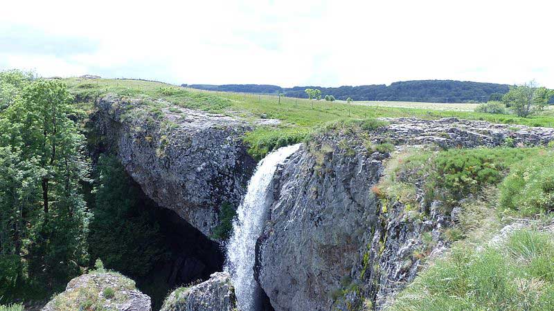
Au milieu des vastes étendues de l’Aubrac granitique lozérien, la cascade du Déroc domine de 30 mètres la petite vallée glaciaire du ruisseau de Gambaïse.
Au bord du ravin, l’affluent du Bès et les eaux du lac de Salhiens se précipitent du haut d'une falaise basaltique (correspondant à une ancienne coulée de lave) et retombe 32 mètres plus bas.
La cascade cache une petite grotte dont le plafond est formé de prismes basaltiques (ou orgues basaltiques).
Cette grotte découverte par le docteur Prunière devait servir de refuge aux brigands de grands chemins.
Photo : https://fr.wikipedia.org/wiki/Fichier:Nasbinals_-_Cascade_du_Déroc_(1-2016)_P1040864.jpg
_P1040864.jpg)